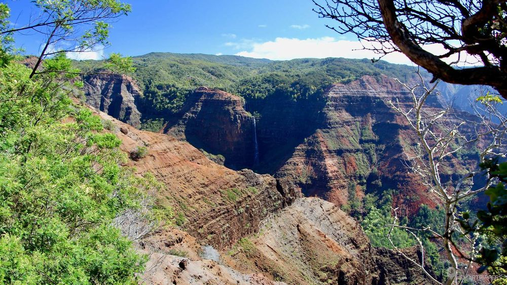
To the west of the island of Kauai, hides a little wonder: the Waimea Canyon. Imagine a canyon 16 km long and 1000 meters deep with the ocean as a backdrop!
Nicknamed the Grand Canyon of the Pacific and although it is more modest than its big brother of the Mainland, it imposes none the less. It covers almost the entire western part of Kauai Island, which is one of the only islands on the planet with such a large canyon!
And to top it all off, the Waimea Canyon has a very strange climate. Here, it's hot and dry. A striking contrast to Mount Wai?ale?ale?ale located only 9 km away, which is the wettest point (or second point following the springs) on earth with almost 12 meters (yes meters!) of rainfall per year. Amazing, isn't it?
1Getting to Waimea Canyon
To go to Waimea Canyon you will have the choice between 2 routes.
- The route recommended by the signs from Kekaha, Kokee Road.
- Or the road from Waimea (the city) called Waimea Canyon Drive (road 550) just before the West Kauai Technology & Visitor Center.
We recommend the Waimea Canyon Road, because on the way you will come across the Red Dirt Falls, a cute little corner, parallel to the Waimea Canyon, which will delight lovers of beautiful photos. And the ascent from this road is nicer.
Red Dirt Falls
This is the first point of interest you discover when climbing up if you've taken Highway 550, just before entering the park. These are small streams that come out of nowhere and form small waterfalls. On sunny days, the contrast between the blue sky, the ochre colour and the white of the falls offers a magical setting to this place!

Park on the side of the road. If you want to approach the small waterfalls, you will have to cross the barrier on the side of the road. It should be noted that, like all rivers, the flow rate can vary according to the last rainfall.
2Viewpoints on the Waimea Canyon
The road leads to the canyon. It rises slowly and the altitude is felt because it is cooler, which is not unpleasant. Shortly after entering the park, the two access roads meet. The road then winds between the trees.
In some places, small panoramas, more or less fitted out, will allow you to admire the views on the canyon which appears gradually. Don't hesitate to stop by. Parking is then on the lower side, where there is usually enough space to park. Be careful not to encroach on the road.


Waimea Canyon Lookout
The first "official" lookout is the Waimea Canyon Lookout. A car park will give you access to a platform from which you can admire the canyon. From here you will enjoy the relief of the canyon, but you won't see the Waipo' o Falls yet.
Pu'u Ka Pele Lookout
The second point of view is at Pu' u Ka Pele Lookout. There is no parking, but it is possible to park by the roadside. Barriers have been placed at the edge of the cliff to protect the viewpoint. From here you can see the Waipo' o Falls on the east bank of the canyon, which is on the other side of the canyon.

Pu'u Hinahina Lookout
The third point of view is the Pu' u Hinahina Lookout, whose car park is located just before the small sign "ELEV 3500 FEET". Here you will have a beautiful view from the back to the beginning of the canyon. It is from here that the most famous trail of the park, the Canyon Trail, starts, which will be discussed just below.
3Discover the Waimea Canyon on foot
Notice to walkers. The Waimea Canyon is surrounded by several trails, very varied. We only had time to choose one, so we decided to drag our shoes on the Canyon Trail.
The Canyon Trail
The trail starts at Pu' u Hinahina Lookout. Please note that there are toilets on site (there will be no more after). It is also possible to reach the Canyon Trail a little further, to avoid the first monotonous part, by driving to the end of the Halemanu Road with an SUV.
With a length of 1.8 miles, or 2.8 km from Pu' u Hinahina Lookout to the top of the Waipo' o Falls, or 5.6 km round-trip, it allows you to tour the northern part of the canyon while making you discover beautiful and breathtaking views of the canyon. Allow 1 hour to reach the Waipo' o River, or about 2 hours to make the round trip.

Overall, the altitude difference is not great, but the trail only climbs and descends, which can make the hike difficult, especially in hot weather. The first section, up to the intermediate car park at Halemanu Road, is downhill, with a rather steep section. Then it goes up to an intersection.
We're giving you some pointers because the signs are frankly not clear:
In front of the first fork (22.112489, -159.665049), if you turn right, you will walk for 150 meters until you reach the Cliff Trail Lookout which will offer you another view of the canyon. Then we'll have to turn back. The Canyon Trail, on the other hand, continues on the left at the intersection.


A new section of descent in short laces followed, then a new ascent. You finally arrive at a new intersection (22.109455, -159.663716). Again, it's not the signs that will help you!
We waited until the last group to ask them what direction to take. They didn't know either, so we waited together for a family to go up the trail in the opposite direction to confirm our direction!
So, to continue on the Canyon Trail, you would have to take the path that goes down, slightly to the right. The path on the left is the Black Pipe Trail, and it goes up to Halemanu Road a little higher.
From now on, the trail will go almost continuously down to the top of the falls. This is where you will discover the most interesting part, from where it is possible to get close to the emptiness. Here the colors are incredible: green, red, orange with hues of yellow. And at the bottom, the ocean! Enough to make nice pictures.

Be careful when descending as some portions may be very slippery, as they are very dry and slightly sandy.
The trail continues its descent, it is the steepest part of the trail. At the bottom, you will have to turn to the left to pass under the trees and make a few bends before reaching the river. Here you are, here you are!


But contrary to what we believed, we do not see the falls at any time. Perhaps we should have continued?
The trail seems to stop just above the Waipo' o Falls, but I realize when I write this article and cross-check on our map, that the path seems to continue on the ridge in front of the falls, as I suspected when we were there... Yet, we did not manage to identify a trail on the other side. We just have to go back and check it out!
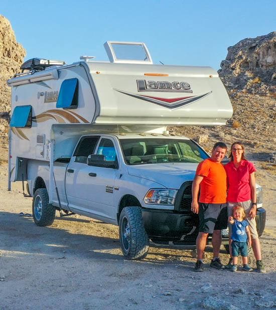
We are Sandrine and Flo, French thirty-somethings. In 2019 we quit everything to live our dream, become nomads and travel around the world. We left with our baby, Lena, who was only 5 months old at the time. After a first trip around the Pacific Ocean by plane and a long 3 months stay in Hawaii, we left to discover Iceland for 3 months on board our 4WD pickup truck and truck camper. Then we continued our adventure in North America.

Today, if we can continue this adventure, it is above all thanks to our blog, Smartrippers! We created it one day in 2016, with the desire to share our good travel tips, without thinking that it would lead us there! We have developed it a lot over the years and have become experts on our 3 favorite destinations: Hawaii, Iceland and the American West. We now guide you to these destinations to help you plan the trip of your dreams!
Follow our adventures!