- Iceland
- North Iceland
- F88 and F910: discovering the Highlands of North-East Iceland

Landscapes desolate as far as the eye can see, where life seems impossible in the heart of a vast desert, the whole dotted with still-smoking volcanoes, lakes, waterfalls and hot springs. Welcome to the Highlands of North-East Iceland!
Such a succession of sets seems unreal, especially over such a short distance. And yet, in 6 hours we were transported to another planet. No wonder NASA chose this training facility in preparation for the Apollo missions! That is to say, the journey that awaits you.
Summary
1The road from Egilsstaðir to Myvatn
We crossed tracks F88 and F910 in July 2016. The route can be taken in both directions, either starting with the F88 or the F910, knowing that there is an alternative via the F905 to bypass the Lindaá ford on the F88. We did not try this alternative, however, as Lindaá was passable when we came here.
Our trip was completed in 2 days, but we should have spent 3 days there because the region is so interesting.
I suggest you retrace it step by step, knowing that we left the first morning from the surroundings of Egilsstaðir, with the objective of sleeping at Askja campsite, to finally return to Lake Myvatn the evening of our second day. In total, a 400 km expedition.
2Along the Lagarfljot: from Egilsstaðir to Hengifoss
Whether you start or end your expedition in the Highlands with the F910, you will probably have to stay in the surroundings of Egilsstaðir, or close to the Lagarfljot, this long lake, very pleasant and lined with trees.
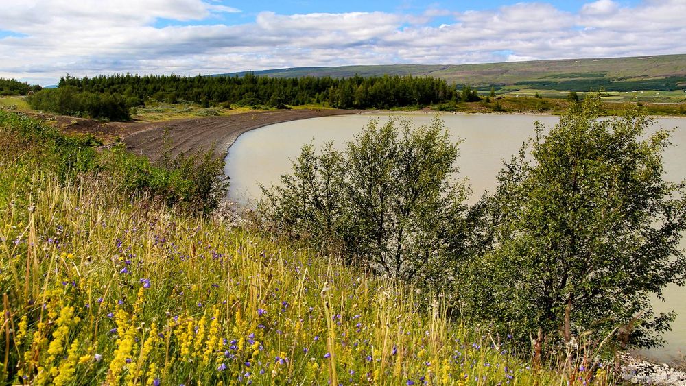
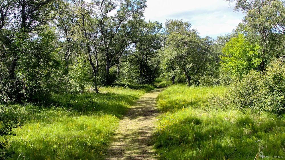
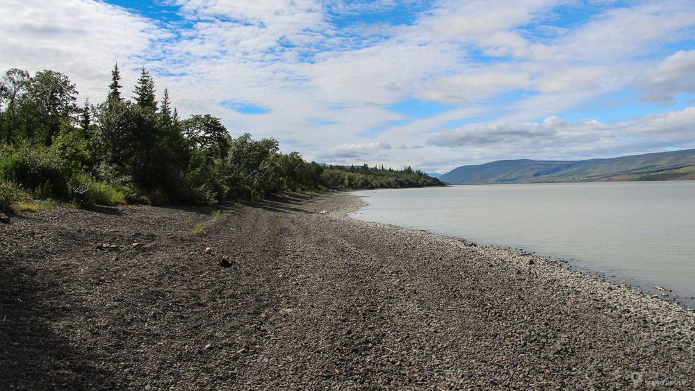
Starting from Egilsstaðir, we recommend that you take route 931 along the southern shore of the Lagarfljot in a very bucolic atmosphere. Here, flowering meadows and trees take their place. The scenery is really enchanting. The road follows the lake where the fir trees alternate with a few deciduous trees, contrasting with all the landscapes we have discovered in Iceland. Several short trails allow you to go down on the banks of the lake.
When you arrive in Hallormsstadur, stop to refuel at the small gas station because there will be no more until Myvatn. And if your 4x4 consumes a lot of fuel (like ours), it's a good idea to fill an extra jerrycan.
Indeed, we almost ran out of gas when we arrived in Myvatn, avoiding the detour to the Kverkfjöl that we dreamed to discover. The journey was therefore extremely just with the only full tank of our Durango Dodge, with an average fuel consumption of 20L/100km.
It should also be noted that the small gas station is not open 24 hours a day. At the time of our visit, the manager had gone to eat. So we had to wait for him to come back for a good half an hour to get food and fuel.
Highway 931 continues along the lake. After a few kilometers, a bridge leads to the other shore. Once on the other side, turn left to take Highway 933.
Lítanesfoss and Hengifoss
5.4 km round trip - 1 hour to 2 hours - Easy (250 meters of elevation gain)
If you have a little time in front of you, stop and admire the beautiful waterfalls of Lítanesfoss and Hengifoss, which are discovered successively during a short 5.4 km round-trip hike, or about 1 to 2 hours walk depending on where you want to turn around.
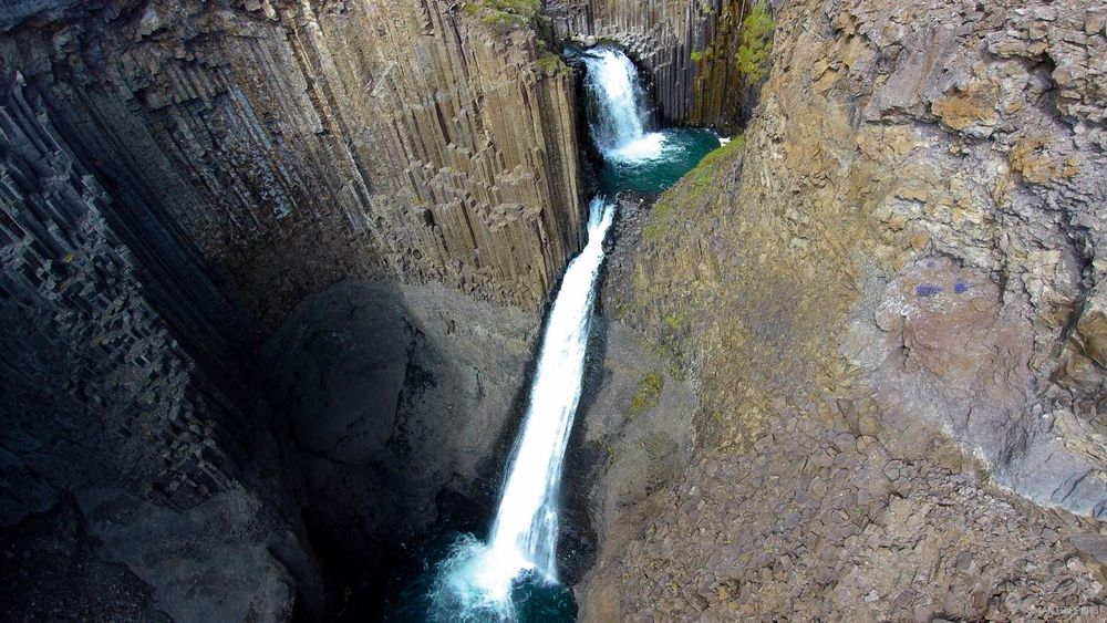
The car park is located 500 meters after the junction between roads 931 and 933, at the exit of the bridge. From here a relatively easy path leads up to the waterfalls. Lítanesfoss is the first waterfall we discover. The waterfall is superb, formed by two successive cascades and adorned with pretty basalt columns.
1.5 km further on is the famous Hengifoss waterfall, famous for its height, 128 meters! , and especially its red striated rocks which make it a fabulous background.
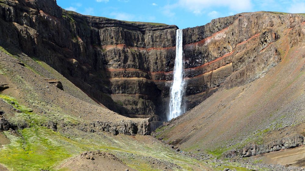
For more information on hiking, I recommend you read our dedicated article: Hiking to the waterfalls of Lítanesfoss and Hengifoss.
3From Lagarfljot to Laugarvelir: first steps on route 910
From the Hengifoss parking lot, route 933 continues southwest. After 2.7 km, we will have to turn on road 910, which will drive us to Askja. The road is not yet called "F910" because it remains paved for almost 50 km until the immense Kárahnjúka dam.
Route 910 quickly rises a little bit of altitude with a few twists and turns before reaching a plateau dotted with streams and small lakes, reminiscent of a sort of large, fairly flat swamp that will be crossed for about 35 km.
A junction indicates Laugarfell, which offers lodging during the summer with 2 hot pools, as well as access to beautiful waterfalls nearby by a short hike (which we did not have the time to do). We had wanted to stop there anyway to enjoy the hot baths but they were full and became chargeable for people who do not sleep in the house.
From Laugarfell, the landscape begins to change and becomes more and more desert. Soon the Kárahnjúka dam will be in sight.
The Kárahnjúka Dam
A first and long straight dam marks the arrival near the immense water reservoir. The road runs on this large rocky dam for about 1 km before continuing on the hillside until it reaches the second dam.
This second dam is much more impressive. It overlooks the beautiful gorges of Hafrahvammagljúfur, which were once safe to discover. Today, their visit has become dangerous, as the reel of the dam throws itself directly at them, threatening to flood the gorges. Nevertheless, the view of the gorges from the dam remains pretty.
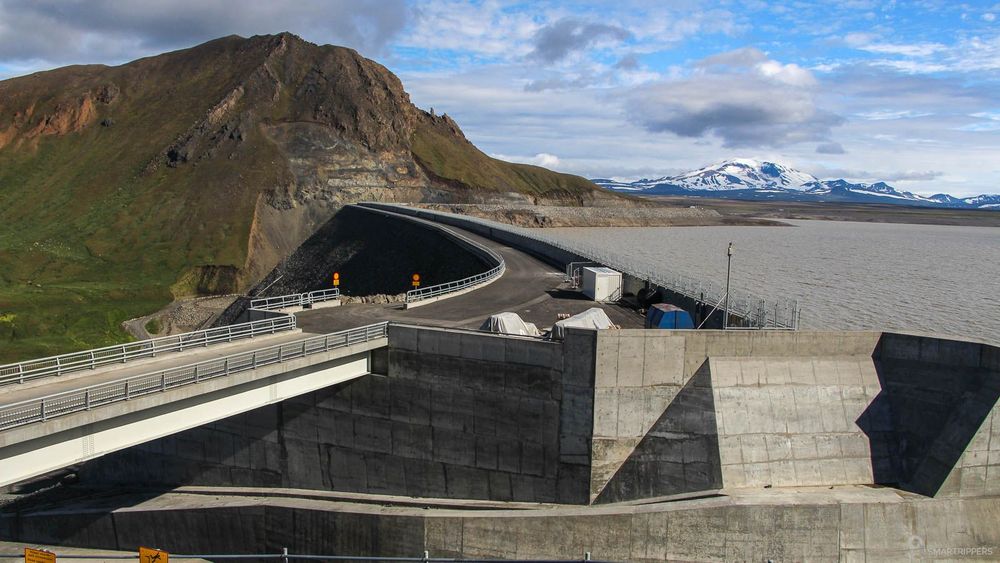
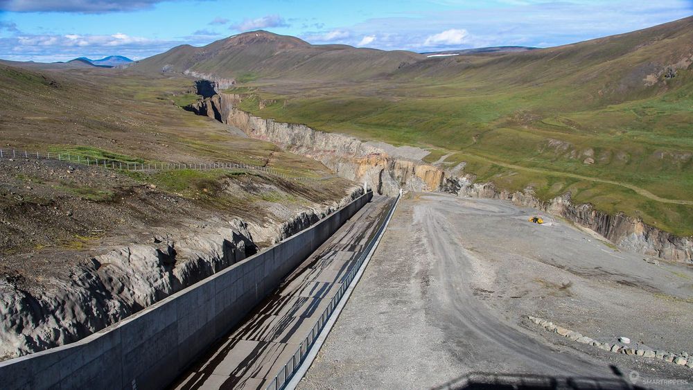
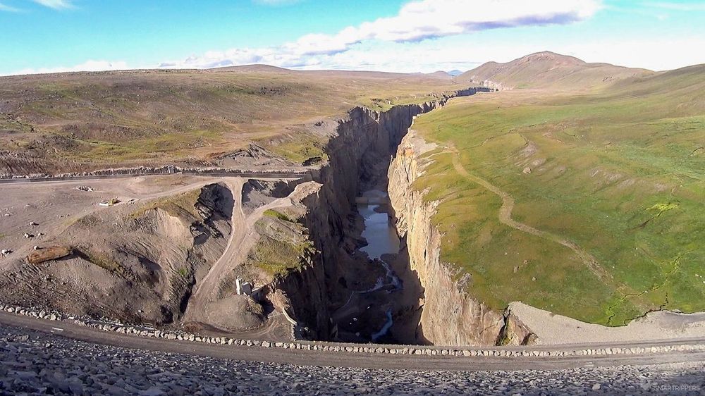
Once on the other side, a small parking lot is available. A few picnic tables have been set up there. A staircase leads up to a promontory that offers an overall view of the architecture of this immense structure which makes it the largest dam in Europe with its 198 metres high and 700 metres long.
The whole structure, consisting of a total of 5 dams, was completed in 2009, after having provoked a lot of controversy, particularly with regard to the environmental and ecological impact, making areas used by animals disappear, but also a canyon and several waterfalls.
From the dam, Route 910 is replaced by F910 road. A 4x4 be required to continue from this point.
Laugarvellir hot waterfall
Approximately 5 km after the start of the track there is a small undeveloped junction leading to the hot waterfall of Laugarvellir. This place is a small piece of paradise in the middle of a desert landscape.
Here, a small stream of hot water flows out of the ground into a cold water river below, forming a small waterfall at 40°C, an extremely rare phenomenon!

For more information about Laugarvellir including information on how to get there, we invite you to read our detailed article: Laugarvellir hot waterfall.
From this place, the scenery changes completely and gives way to a desert of ashes and black sand, where all life seems to have disappeared.
4From Laugarvellir to Askja: the lonely desert of the F910
Here we are now facing the desert, a desert of sand, ash and volcanic rocks that we will cross for nearly 115 km. We really appreciated this long solitary track which made us cross amazing landscapes and varied scenery, which raised it to 3rd place in our ranking of Icelandic tracks.
But be warned, the track is long, very long! We took no less than 5 hours from Laugarvellir to cover the 115 km to Askja, stopping only a few times to take photos. This indicates a lot about the condition of the runway, which will require long stretches of gravel at very low speeds, especially towards Askja.
Also, don't expect to see too many people, at best only 5 to 10 vehicles! This track is not very popular because the access via the F88 is easier to get to Askja, but much less beautiful.
Plains as far as the eye can see
The start of the track is rather smooth with long straight lines crossing an immense plain with brown tones. Life seems to have left these lands a long time ago. Everything seems so calm, so flat, so dry...
Then suddenly the soil starts to turn green. The answer will arrive soon. In this so hostile desert, the glaciers upstream warm up, leaving a bit of water flowing, forming small streams and rivers. Water is the source of all life! As each watercourse approaches, the soil is lined with vegetation, forming small oases full of life, before returning to its dark and dry colour.
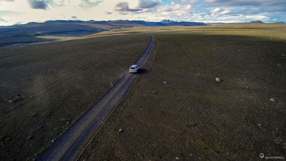
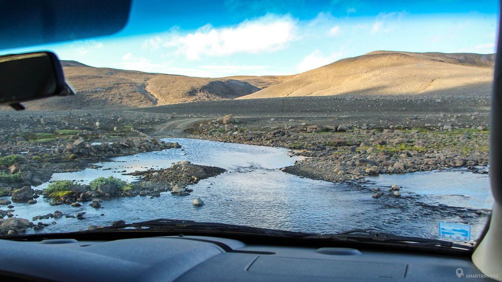
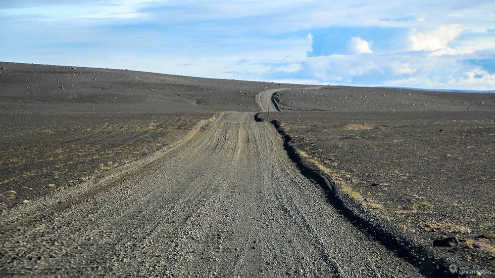
The track runs for long minutes in the heart of these hilly landscapes, seemingly stretching to infinity, in the depths of which water comes to water the land. The trail will cross many times these small streams of water that you will have to cross (only a few centimeters of water). As the road rises, the texture of the ground changes, loading small stones and forming small waves of corrugated sheet, causing the vehicle to vibrate unpleasantly.
It is better to cross these portions quickly so as not to be overly tossed, while avoiding large stones.
Crossing the 2 fords of the F910
The F910 now arrives at the junction with the F905 (the alternative to the F88). We turn south. The trail continues through this hostile environment, then crosses two fords 2 km between each other. The two fords did not seem difficult to us with our Durango, but one of them was 50 cm deep with sand and rocks in the ground.
In fact, we came across a Honda CRV whose driver told us that he had left a piece of his crankcase, torn off by stones, as he was trying to get out. It's a shame for him because the underbody is never insured! It will be recalled again that it is really reckless to take this type of track with an SUV that has a low ground clearance.
Yellow sand and big rocks
After about ten kilometers, the landscape changes suddenly. The brown earth disappears to give way to a kind of pale yellow sand, scattered with large pebbles of black lava offering a very nice contrast. It seems that this land once suffered a violent cataclysm... The Askja is not far away!
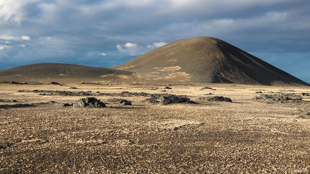

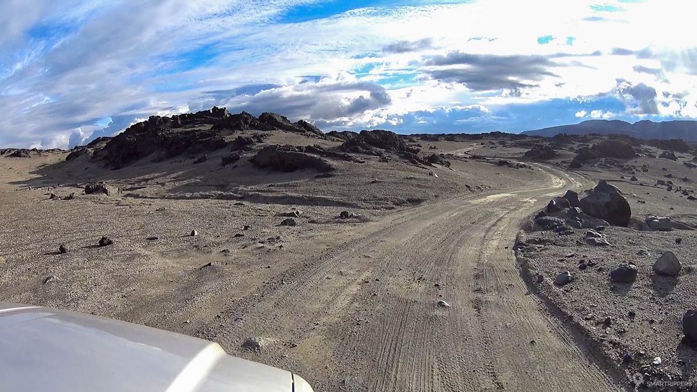
The trail makes its way through the big black blocks. This landscape is fascinating, especially when the sun shines on the vast plain. You'd think you were on another planet, thinking of Mars. On this section the track is more difficult to negotiate because the rocks emerge at times from the track. When you scan the surroundings, you will notice quite quickly to the northwest a kind of mountain with a rather flat summit. It is the imposing Herðubreið, an extinct volcano that once grew under a glacier giving it this particular shape, culminating in more than 1600 meters and dominating the landscape. We'll take a closer look at him from the F88.
It is also in the middle of this fascinating landscape that the imposing Kreppa flows and its monstrous flow, which later forms the Jökulsá á fjöllum, the impressive river that forms the spectacular Detifoss waterfall. But fortunately, a small one-lane wooden bridge was built over the tumultuous, brown-watered river.
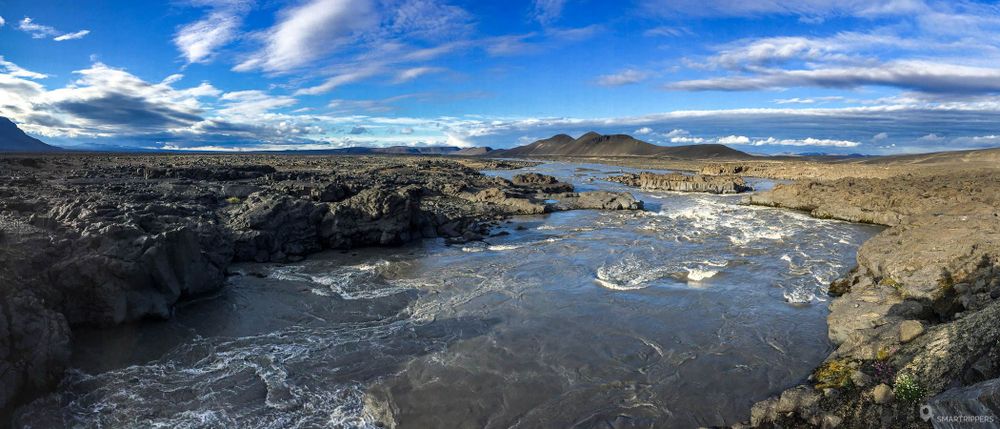
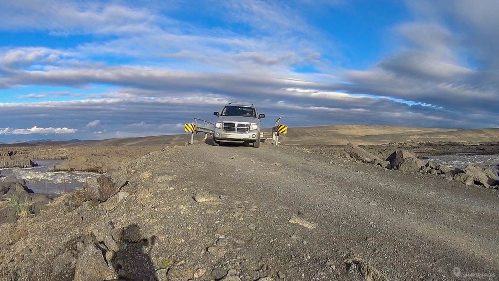
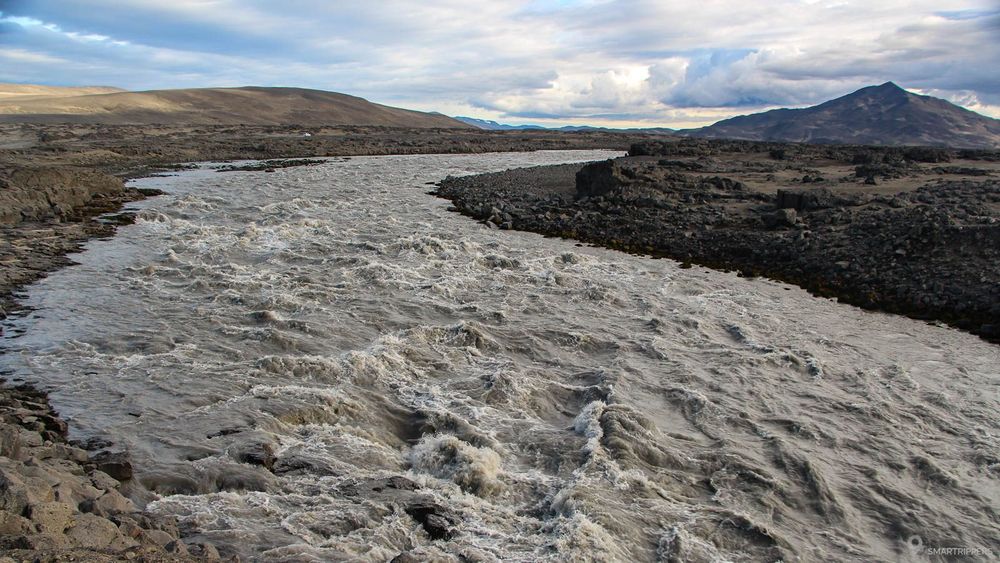
Beyond the bridge, the rocks are growing larger and more numerous. Do not hesitate to park on the side of the track and stroll among the big strange stones.
A few kilometers after crossing the Kreppa, the large rocks disappear and give way again to a large plain with beige shades. You will not be able to miss this strange mountain in the shape of a pyramid, dotted with golden reflections, which will gradually rise up in front of you. Because of the difficult terrain, the track bypasses this pyramid for almost 30 km. Expect to see it on every seam!

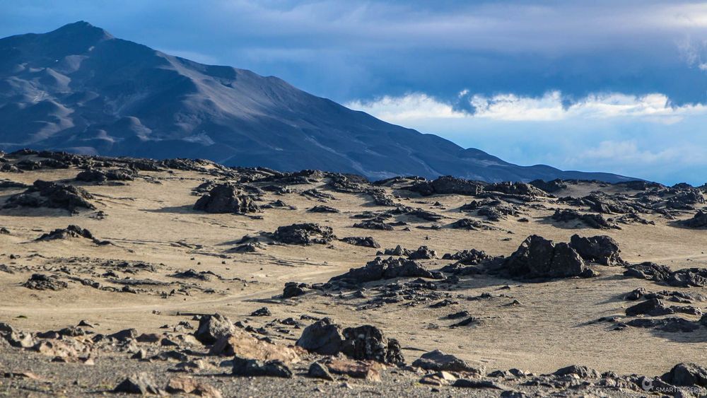

Here, the yellow color becomes more and more present, taking the form of coarse sand that seems to cover the area, offering sublime golden tones when the sun's rays appear.
The contrasts are superb in the shaving sun! We were in the area around 9pm, it was a real feast for the eyes!
For its part, the track is not one of the most pleasant, being scattered with more or less large pebbles, requiring to negotiate with caution certain passages. The end of the track is definitely not rolling, except for a few rather flat portions, running on the yellow sand which make a crazy good (but which never last long enough).
Little by little the light sand gives way to darker rock. Here we are at the gates of u00d3dáðahraun, the largest lava desert in Iceland! We will have the opportunity to discover it in more detail during the ascent of Askja, or along the F88 which runs along its eastern border.
Drekagil campsite
After 115 km of track, we will finally arrive at the Drekagil refuge and campsite, located at the foot of the Askja. In total, it took us almost 8 hours of road from Egilsstaðir to cover the 240 km to Askja. But don't expect a nice haven of peace. The campground is just a vast pebble field, swept by the winds that blow over the highlands. You won't be alone either! Here, many tourists come to discover the fabulous caldera of Askja.
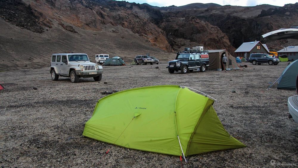
You will have to wait to plant your tent in the hard ground and find yourself in the middle of dozens of tents, all in the cold, because the temperatures are very low in this remote area, often approaching 0°C in summer.
The night in tents for 2 people cost us 1600 ISK in 2016, plus 500 ISK to enjoy 5 minutes of a warm shower. The toilets are fine.
5Around Aska: Between lakes and lava fields
There are many areas to discover around Askja, starting with its gigantic caldera.
Víti Crater and Öskjuvatn Lake
4 km round trip - 1h30 - Easy
From the campsite of Drekagil, an 8 km track, the F894, takes us up to the caldera of Askja. The intersection is at the entrance to the campsite. The track crosses two small fords and then climbs up to a small parking lot (often full because of the crowds). From here we begin to realize the immense lava field that surrounds us, which is only a small part of the immense lava desert of u00d3dáðahraun.
Then, we have to continue on foot. It is after a short 2 km easy ascent we reach the shores of Öskjuvatn Lake and the small Víti crater. The scenery is absolutely breathtaking! The colors of the 2 lakes are of an incredible blue, contrasting with the dark rock.
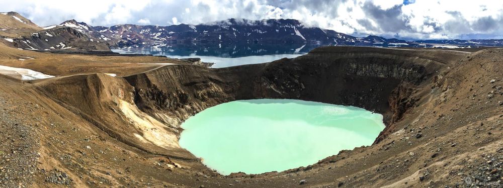
The more adventurous will be able to descend into the steep Víti crater and bathe in its milky waters. It seems that you can hear the snoring of the volcano when you plunge your head into it. Unfortunately, the weather was so bad that day that we didn't have the courage to bathe in it. That is a huge regret, but I honestly think we could not have enjoyed it.
For more information on the short hike to Víti Crater and Öskjuvatn Lake, we invite you to read our dedicated article: Askja: the extraordinary ascent to Víti Crater.
Finally, for lovers of long hikes, it is possible to reach the caldeira of Askja and the 2 lakes by taking a hiking trail starting from the campsite.
Holuhraun new lava field
If you've come to Askja, don't leave just after seeing the caldera, you might miss one of Iceland's most recent geothermal phenomena.
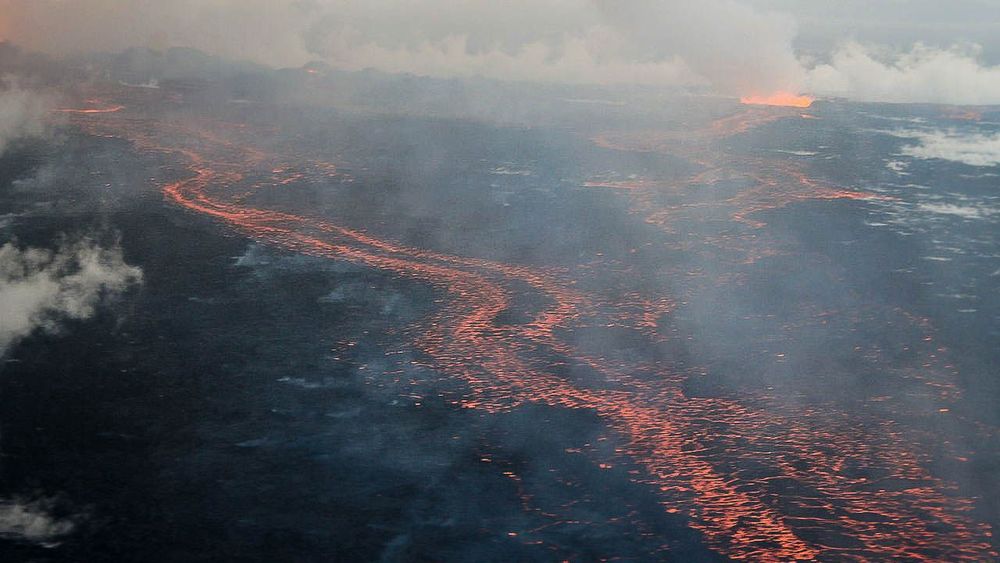
The Holuhraun is a vast lava desert south of Askja and north of the immense Vatnajökull. On 29 August 2014, the Bárðarbung, a volcano under the Vatnajökull, erupted, covered a large part of the former Holuhraun lava field.
The area reopened gradually from August 2015 to allow the discovery of this new flow. In July 2016 we were very curious to observe a recent lava field and we were not disappointed!
Access to the recent Holuhraun lava field is from the F910. From the Drekagil campsite, you have to take the F910, which goes southbound around Askja and is slightly closer to the Vatnajökull. After about ten kilometers, the stony track gives way to a huge desert of black ashes. What a landscape! The car then runs quietly through this endless black plain, where only small yellow pickets mark the track.
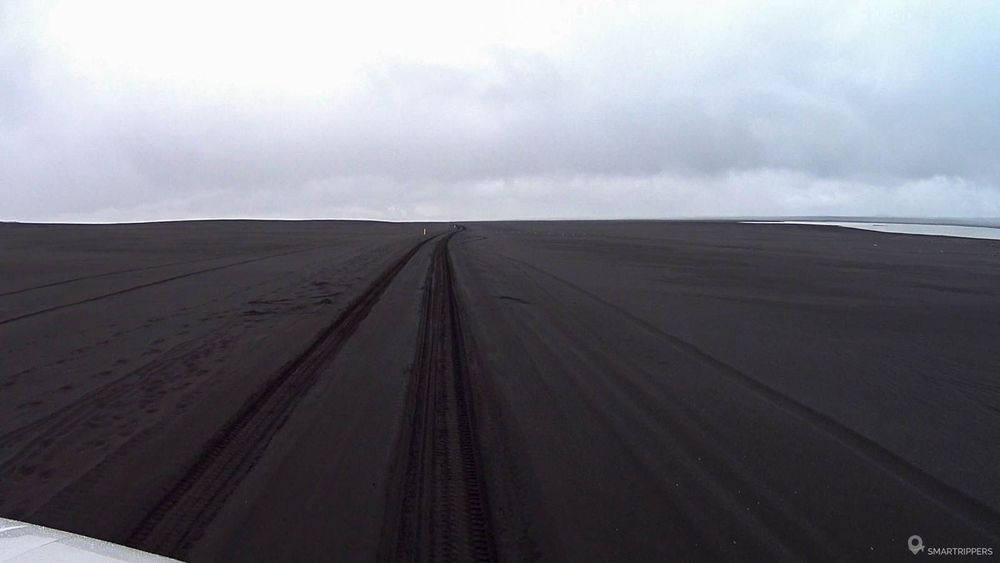
Then in the distance, our eyes are attracted by strange clouds. Although the weather is grey and rainy, we notice these white clouds near the ground. No doubt, this is the still steaming flow of Holuhraun.
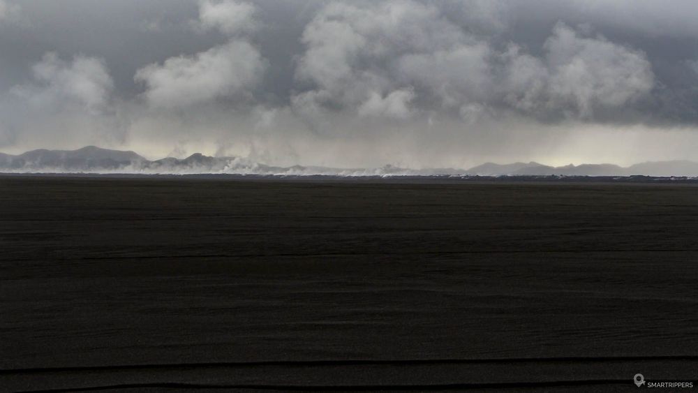
It's amazing to see her still smoke so much nearly 18 months after the eruption
The new lava field of Holuhraun is discovered thanks to a short walk on the flow. By 2016, only the eastern and northern accesses were open (the western access was still too hot and unstable). To learn more about the Holuhraun lava field, its accesses and the hike, we invite you to read our dedicated article: Holuhraun: Exploring a still warm lava field.
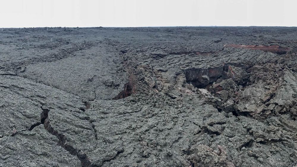
After following the Holuhraun, the F910 continues in this desert of black ashes before approaching the Vatnajökull. The area then becomes very humid, as it is dotted with the many rivers that flow out of the Vatnajökull. During our visit, we met some rangers who alerted us to the fact that the track was cut a few kilometres away by an impassable ford. We then turned around, leaving this region so lonely last us, with a crazy desire to come back to discover it, but it seems that it is one of the most difficult tracks in the country.
We turn back towards the campsite, a little worried to see the fuel gauge go down at lightning speed. The nearest gas station is 140 km away.
6From Askja to Myvatn by the F88
It is time for us to return to civilization after 2 days spent in the Highlands. We have two options: take the F88 and cross the ford on the Lindaá, which can sometimes be impassable, or take the F910 and then the F905.
We decide to check with the rangers who are based in Drekagil refuge. The ranger tells us that the ford on the Lindaá is not very high with only 60 cm of water. Perfect! We're going northbound on the F88.
Herðubreið
The F88 slowly climbs northwards up to the banks of the Jökulsá à fjöllum, where vegetation has taken up its rightful place, covering the gray ground. The change of scenery is radical, moving from a vast lava field to a swampy area, called Herðubreiðarlindir.
The first curiosity we come across is the famous Herðubreið that we had already discovered by far the day before, on the F910. This imposing volcano surprises with its massive form and flat summit, especially since it seems to lie in the middle of the vast lava desert of u00d3dáðahraun. Its summit rises to 1682 meters and is often covered with snow.
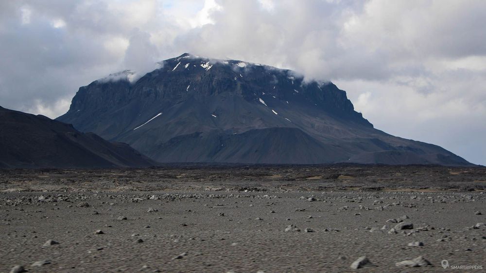
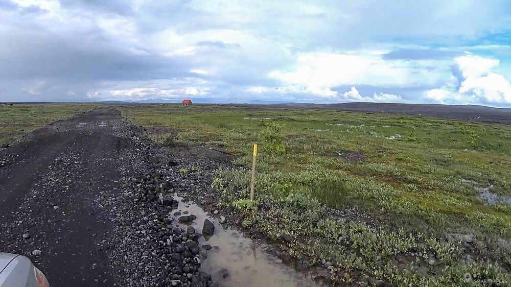
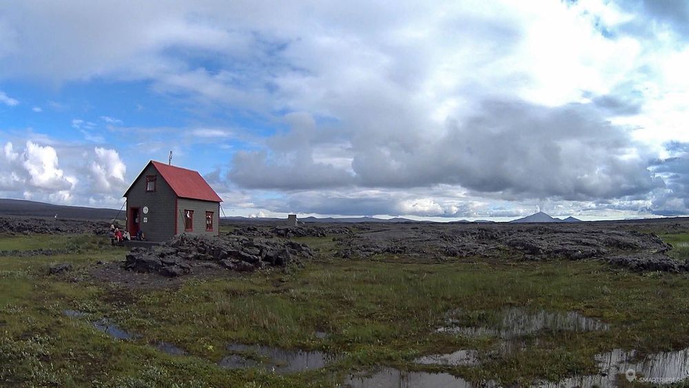
Today, Herðubreið is considered to be an extinct volcano, its last eruption being more than 10,000 years ago. To better discover it, there is a hiking trail, starting from the very small refuge with a red roof situated in the Herðubreiðarlindir, which makes the tour in one day.
Crossing the ford on the Lindaá river
Once past the refuge, the trail continues to cross the swampy area for a short time, where small and safe fords will be crossed.
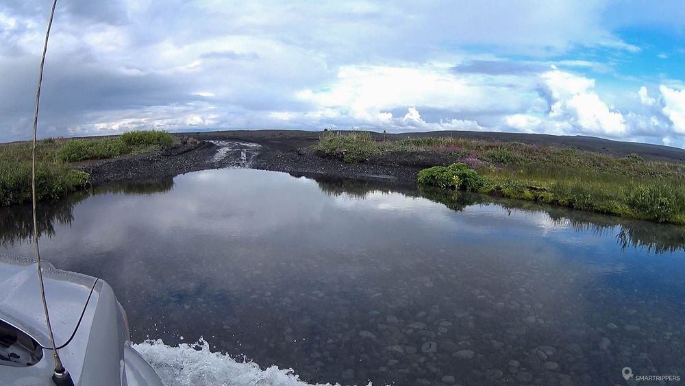
About 10 kilometers further on, the track arrives in view of the Lindaá, a tributary of the Jökulsá to fjöllum that will have to be crossed
Like all Icelandic fords, the water level can vary widely and make the river sometimes impassable with a normal 4x4. Be sure to check before your departure to see how high the Lindaá level is.
The ford is rather wide, delimited by a rope downstream. A small sign warns that crossing the ford can be complex for small Jeeps and makes it clear that you must stay close to the rope.
Although the exit is located on the opposite side of the road, it is important to make the detour marked by the rope, even if it extends the distance in the river.
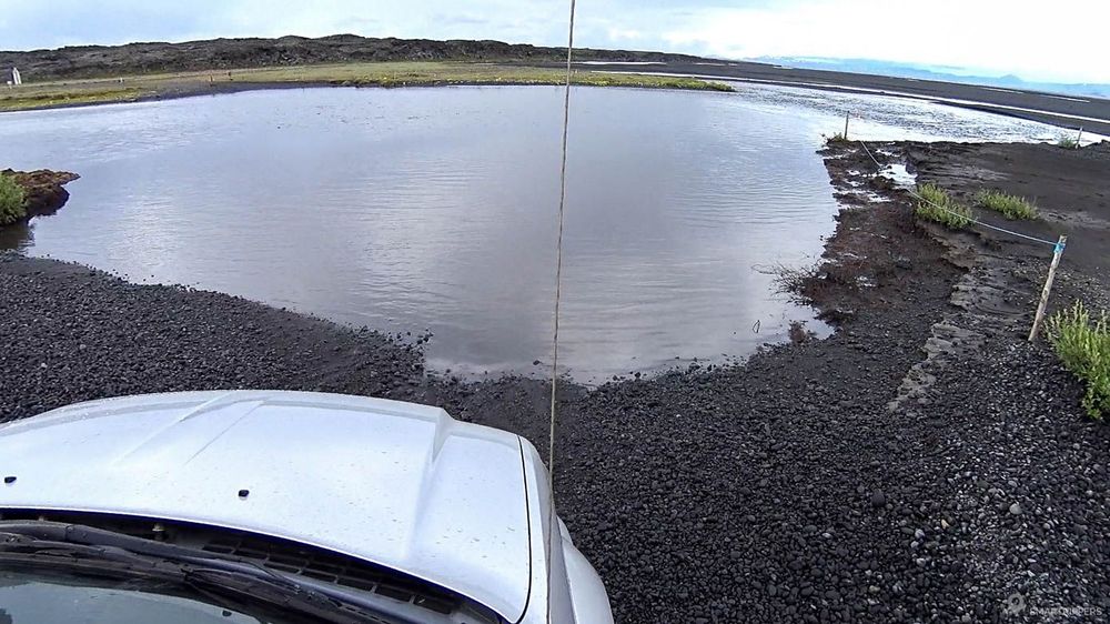
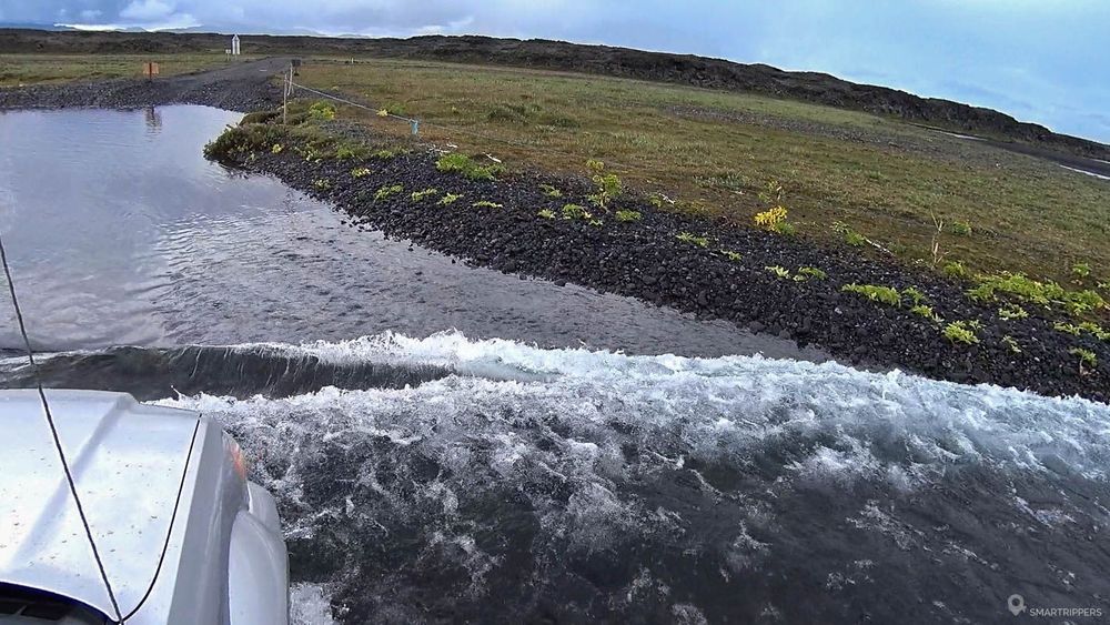
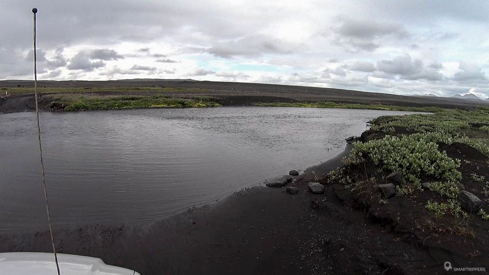
Encouraged by the ranger's claim that the level was 60 cm, we go without thinking too much about it. We walk quietly in the ford, along the rope without sticking it, about 3-5 meters. What a mistake! We were so confident that we didn't think about analyzing the situation.
In fact, the lowest water level is found at the rope level. By not approaching the rope, we crossed the ford in the wrong place and at the wrong angle, on one side with 60 cm of water, and on the other side more than 80 cm, the water coming almost under the windows! Luckily the crossing went well but it could have ended badly.
From Lindaá river to Myvatn
After crossing the Lindaá, the F88 continues its journey along the edge of the great u00d3dáðahraun, passing in the middle of huge fields of grey lava, where vegetation gradually begins to regain its rightful place. After several kilometers the track crosses again a ford similar to the Lindaá, but in much less depth.
Then the track becomes more monotonous and less grandiose, always passing through hostile landscapes. The end of the trail didn't thrill us. The track is well rolling but dotted with a few stones and traces of corrugated sheet. It is not very pleasant and the landscapes are rather monotonous. We are looking forward to finally arriving on the softness of the asphalt that we finally make it back after 100 km of track traveled in a little less than 2 hours.
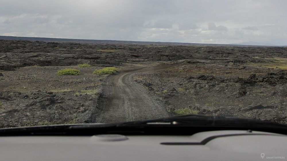
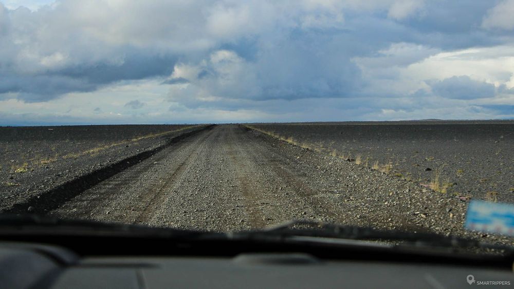
We quickly stop to the first gas station that we meet near Myvatn Lake. We had already reached the fuel reserve and with no many kilometers before the dry run!
Here we are at the end of this 2 days expedition in the North-East Highlands. Even if we loved these two days, we would say that our favorites go to Laugarvellir and its hot waterfall (but which is starting to be more and more known), to the whole of the F910 track as well as to the magnificent view of the Víti crater and the Öskjuvatn lake. We also greatly appreciated the fascinating discovery of Holuhraun's smoking lava field, too bad the weather was not with us that day. Finally, when we look more generally, we liked everything except perhaps the F88. Our only regret is that we didn't have enough gas to discover the Kverkfjöl.
We are Sandrine and Flo, French thirty-somethings. In 2019 we quit everything to live our dream, become nomads and travel around the world. We left with our baby, Lena, who was only 5 months old at the time. After a first trip around the Pacific Ocean by plane and a long 3 months stay in Hawaii, we left to discover Iceland for 3 months on board our 4WD pickup truck and truck camper. Then we continued our adventure in North America.
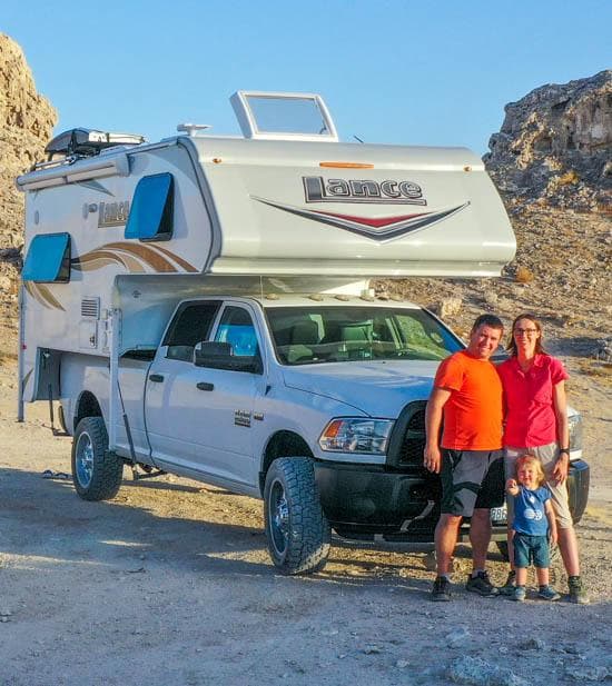
Today, if we can continue this adventure, it is above all thanks to our blog, Smartrippers! We created it one day in 2016, with the desire to share our good travel tips, without thinking that it would lead us there! We have developed it a lot over the years and have become experts on our 3 favorite destinations: Hawaii, Iceland and the American West. We now guide you to these destinations to help you plan the trip of your dreams!
Follow our adventures!